Featured Products
3D resistivity and induced polarization (IP) surveys with the Full-Waver technology
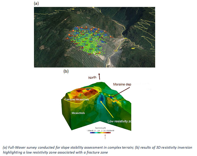
Large-scale 3D electrical imaging surveys can provide unique information on the subsurface resistivity and chargeability structure for watershed scale characterization of the subsurface architecture, assessment of slope stability (e.g. landsides) and for locating major mineral deposits. Subsurface Geophysical Solutions (SGS) is pleased to offer the FullWaver technology for larger-scale mapping of 3D resistivity and induced polarization structure in situations where data acquisition using conventional electrical geophysical instrumentation is impractical. The FullWaver technology is specifically designed for 3D data acquisition over complex terrain (e.g. difficult topography), which is often the situation when performing measurements at the scale of entire watersheds, or greater. The FullWaver technology provides a solution for resistivity and induced polarization surveys in any situations where running long cables is impractical. Another example is in urban or industrial settings where conventional cables pose a safety issue. Another advantage of the FullWaver technology is that electromagnetic and capacitive coupling effects that often corrupt IP datasets are largely eliminated.
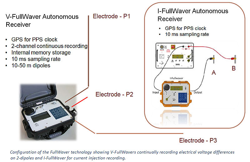
The FullWaver works by replacing a central receiver unit with data loggers (V-FullWavers) that continuously record the electrical potential gradients between pairs of electrodes that can be organized on a sparse, irregular grid. Similarly, the current injected via a transmitter between two drive electrodes is also continuously recorded by a data logger (I-FullWaver). All FullWavers are time synchronized to one another. Typically ~15-20 V-FullWavers are distributed in conjunction with the I-FullWaver, and 3D surveys are made up by progressively moving the system over the survey location. The V-FullWavers capture the electrical fields resulting from the current injections made with the I-FullWaver. All units are retrieved at the end of the survey. Supporting software downloads the data stored in the V-FullWavers, performs data quality control and automatically reduces it to a conventional format appropriate for inversion using 3D processing software. The software also provides the user access to the raw data if desired (e.g. for research purposes). For more information, including a video showing a concise overview of the operating principle of the FullWavers, visit: http://www.iris-instruments.com/v-fullwaver.html
The FullWaver is an excellent solution for large-scale 3D surveys, with obvious value for watershed-scale characterization of aquifers, slope stability assessment, mineral exploration and large-scale mapping of saline intrusion.


